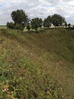
Really like the composition of this image.
Thank you, Mark. It was taken at the giant memorial at Thiepval.
Follow along with the video below to see how to install our site as a web app on your home screen.
Note: This feature may not be available in some browsers.
Ad: This forum contains affiliate links to products on Amazon and eBay. More information in Terms and rules
Really like the composition of this image.
Thank you, Mark. It was taken at the giant memorial at Thiepval.
View attachment 643205Great War Tour 26
Its hard to get or imagine a true perspective on this kind of thing.
Hawthorn mine exploding at Beaumont Hamel, Somme, France, 7.20 a.m. lst July 1916. The mine was exploded by 252 Tunnelling Company, Royal Engineers using about 40,000 lbs of ammonal. The resulting crater was 80ft deep and measured 150 yds by 100 yds.
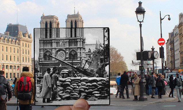
Agreed. You might like this 2016 video I just found. We've all seen those haunting images that overlay an old, usually WW2 photo, ontop of a modern photo of the same location. Well this guy did the same thing with film. There's a wee bit of footage of La Boisselle in there, and the Beaumont-Hamel mine explosion is included.