crash site raf culmhead 1941

Ad: This forum contains affiliate links to products on Amazon and eBay. More information in Terms and rules

stuart3009

Airman
63
5
Sep 9, 2019
help!!!!

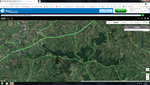
im doing some reaserch on a crash site that happened near raf culmhead august 1941 ive got a copy of the crash card which took ages was wondering if anyone has any connections or idea where i can get any info on where abouts it crashed as from the info ive been given it dont add up it states 3miles from culmhead
 
yes i know aircraft type its Hurricane Z2913 ive tried google al it states where it crashed near like i said ive done reaserch and it dont add up ve tried maintance unit but keeps taking me to nation archives
 
The Hurricane Z2913 was the MK. IIB and belonged to no. 302 Polish Squadron, the base RAF Churchstanton, Somerset. . She was coded WX-D. The plane was crashed on 24th August 1941 while approaching the base. She was flown by Sgt. Eugeniusz Kropiwnicki P-783499 PAF, age 22, who was killed.
On returning from a convoy patrol the Hurricane developed the engine trouble and crashed 3 miles east of the airfield. Two locals, Mr. Charles John Smith and Mr. William Henry Harris risked their life dragging the pilot free from burning wrackage of the plane. But it would seem he had already died.

the info source: 24.08.1941 No. 302 Squadron Hurricane IIb Z2913 WX-D Sgt. Kropiwnicki
 
yes thants the info ive got so if u were to fly from culmhead to merry harriers its not 3miles more like 1 and half ive tried every way possible to get location of crash site
 
Humm.. so it might have been a mistake with the distance. Possible it could be 3 km but not the 3 miles... In the case it would be just about the 1.5 miles

Also the distance should be measured from the center of the airfield but not from its borderline or tip of a runway.
 
no ive got crash card it says 3miles. the arrow is where is supose to come down but distance from one point to another now thats 3miles but from runway to pub is 1.5miles
 

Attachments

  • Untitled.png
    Untitled.png
    928.6 KB · Views: 179
Also found this....
"Tragedy stuck on 24 August 1941, when Hurricane Z2913 "WX-D" of 302 Squadron crashed, killing the pilot.
The aircraft was returning after carrying out a convoy patrol and it was seen to pass very low over the Merry Harriers Inn with obvious engine trouble. It then crashed into a field beyond and burst into flames, whereupon and with great courage, two local people, Charles Smith and William Harris extricated the pilot, only to find that he was dead."

the info source: Culmhead
 
crash card
 

Attachments

  • A.M.Form1180_Hawker_Hurricane_Z2913 (1).pdf
    182.5 KB · Views: 165
IMHO you shouldn't measure the 3 miles from the runway but from the center of the airfield. The info above suggests the Hurricane was crashed on a field behind the inn. So the location of the crash site depends on the heading the pilot kept trying to get the landing course on that day.
 
thanks for reply i dont knkow what heading he was heading back im only going on what ive been told
 
I see. Just a question , is the line drown east in the map you posted above?

According to my knowledge the North is at the top of your map. So you should be looking for the crash site on the right side of the map but not at the left-top corner. In other words the plane was crashed east of the Churchstanton ( airfield ) but not northwest.

Also I can notice that the map uses the nautical miles while the land miles could have been used for the report. The difference is almost 730 m what is almost a half of a mile or 799 yards.


And , secondly, which Merry Harriers inn.. I have found two ... ;)

Merry Harriers.jpg
 
Yes I thought the same. However the inn is about two miles north-west counting from both the center of the airfield and the Churchstanton.
The report states it was crashed 3 miles east of the Churchstanton. So I think the crash site should be on the right side of the airfield. It is very likely the pilot wanted to land on the runway 10-23. Perhaps he could come to point where the the final round should start.

mm1.jpg


mm2.jpg
 
Looking at it a little differently, if the Sargeant had come in from the NW low over Merry Harriers aiming to hook a right base into Rwy 26 and lost it turning base or final, he would have come down just about three miles east of Churchstanton CROSSROADS, not the airfield. Did the crash card explicitly state "airfield"? Good luck!
Cheers,
Wes
 
sorry not been on in a long time ive looked at all the info and all the calculations that u have put out yeah they are all right but here comes the puzzle what im trying to figure out is WHERE!!!! abouts did it crash as it passed over merry harriers. ive tried raf museum london and nothing i did see a eveacuee story but all she said is that she saw crash and then went into a field to pick up metal she has not mentioned where oh she passed away 2010
 
hi
It might be worth researching the local county police war diaries, usually held in the county record office
or the civil defence war diaries, ( used to be in the taunton record office )
Or 67MU records at the NA kew, ( they were the south west recovery unit )
They usually give a more accurate site location, as the official card was usually vague on location, unless it gave the wartime grid map reference
Cheers
Jerry
 

Users who are viewing this thread

Back