I Hope This is the Right Place...

Ad: This forum contains affiliate links to products on Amazon and eBay. More information in Terms and rules

53
0
Nov 12, 2010
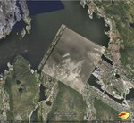
this is a areal recon photograf tanken over cologne.

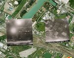
what i need is help to determent what the thing that i have ringed in is

10090004.jpg


yours
Conrad
 
Hard to tell at that size of pic. And which ring are you referring to? Do you have a larger pic?

By the date, its probably showing bomb damage in various areas post-war.
 
Conrad,

Are you asking about all 5 of the circled items (three are yellow and two are red) or about one specific location? Once you have identified which item (or items) we are looking at, someone can give you a better answer.

Kind regards,
Mark
 
Ok,

Red 1 is a damaged railway bridge.

Red 2 is the Cologne Cathedral.

The others are harder to identify, although comparison with modern-day Cologne via Google Maps or GoogleEarth may be helpful.

Hope this helps (a little!).

Cheers,
Mark
 
according to the coordinates given on that website, this is what the area looks like today.

from Bing Maps / bird's eye view.
 

Attachments

  • cologne.jpg
    cologne.jpg
    140.7 KB · Views: 245
This might help. Overlay on Google Earth

Flexi
 

Attachments

  • Cologne.jpg
    Cologne.jpg
    250.4 KB · Views: 187
It's fairly easy.

There are several website that have done some of the important raids already and provide a link that opens up a file in Google Earth.

In Google Earth pull into the appropriate area/town your interested in, click "Add", then "image overlay".

You then get a new window opening. Choose "browse" to locate your image, name it or it can get lost.

Then have hours of fun rotating, resizing your image using the green markers until it fits the Google map. There is a "transparency" slider bar that is very useful.

I have entered all my Dad's missions over the Italy and the Balkans during WW2. I have his original target photos.

Dad liked Milan so much they went back twice in one night!

I have done some for a few other people as well.

Lancaster raid on Bergen.

They look a little static on here but on Google Earth, using the transparency bar it is quite revealing to show the town underneath as the image is made transparent.
 

Attachments

  • Bergen Raid semi transparent.jpg
    Bergen Raid semi transparent.jpg
    171.3 KB · Views: 164
  • Milan Google Earth.jpg
    Milan Google Earth.jpg
    198.1 KB · Views: 152
Last edited:

Users who are viewing this thread

Back