Request for assistance: How to interpret an RAF Accident Card (MFC77)?

Ad: This forum contains affiliate links to products on Amazon and eBay. More information in Terms and rules

JensPlahte

Airman
11
3
Dec 26, 2024
Hi all. I am a complete newbie to this forum. I hope it's okay that I ask for assistance in interpreting an RAF Accident Card (MFC77) that was kindly sent to me by the RAF Museum. I also hope it's okay to upload the card itself. I have the following details in place already:
ID: LN 531
Aircraft: Vickers Wellington
Unit: Royal Air Force No. 16 Operational Training Unit RAF
Crash date: 11. Dec. 1943
Crash site: Little Rollright, Oxfordshire

The entire crew perished. One of them was my grandfather's brother. Hence my interest in the subject matter.

I have found some information at:
and

I am hoping that some additional information could be gathered from the card. I would be grateful for any assistance that may be provided by members of the forum.

Kind regards, Jens Plahte, Oslo, Norway
 

Attachments

  • MFC77-16-80 879 RAF Museum.pdf
    976.3 KB · Views: 6
  • MFC77-16-80 878 RAF Museum.pdf
    981.6 KB · Views: 4
Aircraft details on front sheet; pilot on reverse. Court of Inquiry found faulty descent through cloud procedure by pilot; AOC and AOC-in-C concurred. Duration of flight: 5 hrs 35 mins, crash at 23:03 hrs.

Pilot with 203 hrs solo; 62 on type, of which 49 at night and 33 on type. Looks like '192' was corrected by the Court of Inquiry to 203 (possibly including recent/last sortie)

Crew details will be available on the Commonwealth War Graves Commission website.
 
Hi all. I am a complete newbie to this forum. I hope it's okay that I ask for assistance in interpreting an RAF Accident Card (MFC77) that was kindly sent to me by the RAF Museum. I also hope it's okay to upload the card itself. I have the following details in place already:
ID: LN 531
Aircraft: Vickers Wellington
Unit: Royal Air Force No. 16 Operational Training Unit RAF
Crash date: 11. Dec. 1943
Crash site: Little Rollright, Oxfordshire

The entire crew perished. One of them was my grandfather's brother. Hence my interest in the subject matter.

I have found some information at:
and

I am hoping that some additional information could be gathered from the card. I would be grateful for any assistance that may be provided by members of the forum.

Kind regards, Jens Plahte, Oslo, Norway
I'm the opposite of an expert, but found this fascinating. I knew there was extensive use of early computer-type cards for various information, but had never seen this version before. Thanks for posting.

I can't be of much help deciphering the technical data on the card, but the comments appear to me to be [with my interpretation of acronyms in brackets]:
A/C flew into ground at high speed - reason N/K [not known]
C of I [cause of incident] faulty descent thru cloud procedure by pilot
AOC & AOC in C [Air Officer Commanding and Air Officer Commanding-in-Chief] concur

Found two other google hits on this incident. First here: (page 59)

LN531. Wellington X of 16 OTU Upper Heyford. Hit ground coming out of cloud at night, Little Rollright Ox. 7k.

And secondly here:
16 Operational Training Unit RAF Upper Heyford, Wellington X aircraft LN 531 flew into high ground in extremely poor visibility conditions at Little Rollright near Chipping Norton, Oxfordshire, England

Sergeant HO Mitchell (RCAF), Sergeant BN Redmond (RCAF), Sergeant J Foote (RCAF), FS E Leseberg (RAAF), Sergeant E Harris (RAFVR), Sergeant VM Plahte (RNAF) and Sergeant F Nichols (RAFVR) were all killed

Sergeant Mitchell was BROTHER to Sergeant James Walton Mitchell (RCAF), killed 1944-08-21 on 415 Sqn Halifax NA 609 QO-X, involved in a mid-air collision with 415 Sqn Halifax MZ 633 QO-B

From which I'd conclude the Wellington was on a night training mission and (piloted by Flight Sergeant D. E. Leseberg of the Royal Australian Air Force) descended through a low cloud deck and impacted the ground at a high rate of speed.
 
Dear Sabrejet,
Dear Retattack,

Thank you for your kind contributions! Very helpful indeed!

Earlier this year I found the following information on a website which has now disappeared (chippingnortonroyalbritishlegion.com):

'11th December 1943: Vickers Wellington LN531 of 16 Operational Training Unit took off from Upper Heyford at 1728 on a night cross country training flight. The aircraft emerged from cloud at 2303 and flew into high ground at Little Rollright killing all the crew.
[…]
A Flying Accident report stated 'The aircraft struck the ground at approx 22 degrees at high speed and it was literally level at the time of impact. Both the engines were running under power at the time. The engines disintegrated and were thrown forward. Also the wing tanks were thrown forward and burnt. The reason for the accident is obscure. The aircraft appeared to fly into the ground at about a 20 degree angle and at high speed, literally level with power on'.

Here's my interpretation of the incident:

Based on the crew's military ranks and the pilot's relatively few flying hours, it seems that the entire crew was in training - that is, there were no instructors on board.

It seems that the aircraft has lost altitude in a trajectory that has been around 20 degrees to the horizontal plane, but that the aircraft itself has been horizontal in the air. In other words, it has not been a matter of the aircraft performing a dive, be it controlled or uncontrolled. The aircraft has had both engines running, and has been at high speed, which is natural since it was in the process of losing altitude.

Nothing indicates that this was an unsuccessful attempt at an emergency landing. There is no information that any form of distress signal was sent out. Nor is there any information that the crew had been preparing for landing by folding out flaps and lowering the landing gear.

To me, it seems most likely that the crew has somehow misnavigated. Either they may have mistaken the position and thought they were over lower terrain. Or they may have mistaken the height and thought they were further away from the terrain than was the case. But this is just speculation from a layperson.

Any comments will be highly appreciated.

Then lastly I have one specific question about the Accident Card: What do the words on the Weather section mean ((VIS L.T.; REP.; ALL; ICE)?

... and one question about the Flying Accident report which is referred to above: Do you have any idea if a copy of the report might be available at some military archive somewhere?

Regards, Jens
 
Aircraft details on front sheet; pilot on reverse. Court of Inquiry found faulty descent through cloud procedure by pilot; AOC and AOC-in-C concurred. Duration of flight: 5 hrs 35 mins, crash at 23:03 hrs.

Pilot with 203 hrs solo; 62 on type, of which 49 at night and 33 on type. Looks like '192' was corrected by the Court of Inquiry to 203 (possibly including recent/last sortie)

Crew details will be available on the Commonwealth War Graves Commission website.
Thanks a lot ... please see new post.
 
I'm the opposite of an expert, but found this fascinating. I knew there was extensive use of early computer-type cards for various information, but had never seen this version before. Thanks for posting.

I can't be of much help deciphering the technical data on the card, but the comments appear to me to be [with my interpretation of acronyms in brackets]:


Found two other google hits on this incident. First here: (page 59)

LN531. Wellington X of 16 OTU Upper Heyford. Hit ground coming out of cloud at night, Little Rollright Ox. 7k.

And secondly here:


From which I'd conclude the Wellington was on a night training mission and (piloted by Flight Sergeant D. E. Leseberg of the Royal Australian Air Force) descended through a low cloud deck and impacted the ground at a high rate of speed.
Thanks a lot ... please see new post.
 
I see that the Pilot was an Australian from his service number 425172, Daniel Ernest Leseberg, so his Casualty file is digitalised on National Archives Australia. The Form 765c Report on a Flying Accident and an extract of the Court of Inquiry are at the link below, Images 19 to 21.

Alan.
Hi Alan, Thank you so much for digging out such valuable documentation ... highly appreciated .... evidently, my above draft account and reflections on the accident need revision in light of the newfound material ... Best regards, Jens
 
Hi Jens,
There is more, three crew were Canadian and their Casualty file have been digitalised on the Canadian Archives Site:
Henry Osmond MITCHELL R171550- Better copies of form 765c, full copy of Form 412 Court of Inquiry.
Bernard Nicholas REDMOND R185698 ID Photo
John FOOTE R187590 ID Photo
Collection search
Collection search
Collection search
Although the Court of Inquiry finding is Pilot Error, that is based on what little they knew based on scant evidence. Without a black box flight recorder they would never know if the Altimeter was U/S or if Icing was present.
Let me know if you have any difficulty downloading from the above sites.
Alan.
Hi Alan ... very grateful and almost overwhelmed ... thank you so much!

I agree that the CoI report leans too heavily towards blaming the pilot considering the lack of hard evidence.

Will study thoroughly.

Thank you again.

Jens
 
Hey Jens,
again can't shed any light on the records themselves, but I do have some pertinent experience (flying and accident investigation in the US). I cut and pasted the major narrative sections from the report (from Alan's superb link above relating to Sgt Mitchell):

REPORT BY APPROPRIATE SPECIALIST OFFICERS
No evidence of technical failure or defect. Aircraft struck ground at approximately 22 [deg] at high speed. Aircraft was laterally level at time of impact. Both engines appear to have been running under power at time of impact. Both engines disintegrated, main portion of port engine thrown forward a distance of 430 yards; main portions of starboard engine thrown forward approximately 370 yards. Wing tanks thrown forward up to 350 yards and burnt. Fire appears to have occurred after impact. No local evidence of structural failure or any part of the structure becoming detached in flight. No attempt appears to have been made by crew to attach parachutes to harness.

Shallow cloud layer, base 3000', visibility from four to five miles. Due to full moon conditions the night was very light.

The aircraft appeared to have flow into the ground at about an angle of 20 [deg] at high speed, laterally level, power on.

The reasons for the accident are obscure.

CONCLUSIONS
(a) On the night of 11th December, Sgt Leseberg with a crew of six, was detailed to carry out a cross country and bombing exercise over route. Base Northampton, Reading, Stort Flats, Hartland Point, St. Tudwals, Douglas, Conway Church, Honeybourne, Northampton, Preston Capes Bombing Range, Shottewell Bombing Range. Base, in aircraft LN.531

I took off at 17.38 and W/T messages sent at turning points indicated that everything was going satisfactorily and his E.T.A. base would be 22.48 At 22.35 a message was received requesting a weather report and this was passed at 22.45. Barometric pressure was queried, repeated at 22.51 and acknowledged at once. At 22.52 he requested height of cloud base which was passed as 3,300 feet at 22.57 and acknowledged immediately.

Between the hours of 22.50 and 23.05 LN531 was plotted by the R.O.C. post 1 mile N.E. of Little Rollright, circling this post on a left hand circuit. At approx 23.03 the aircraft turned north and headed in the direction of the Observer post. The motors were heard to rev. up and a few seconds later a crash and explosion occurred as the aircraft struck the ground at 23.05.

The wreckage indicates that both motors were under power at the time of the impact, that the tanks contained petrol and, that the crew were not in distress, or at least preparing to abandon the aircraft.

(b) whilst it is not possible to establish from the available evidence the exact cause of the accident, it is possible to draw certain conclusions and to suggest certain alternatives as to its probable cause. It would appear in the first place that the pilot was a little hesitant about his descent through 10/10 cloud, as is shown by his request, for weather report, ht, of cloud and a repeat of barometric pressure. Sgt Leseberg was only an average pilot, as is shown by his training report, a copy of which is attached at Appendix "C". He was furthermore engaged on only his third solo cross country exercise in weather conditions which had deteriorated more than expected and which were not altogether favourable for a pupil at his stage of training. It is worth noting that Sgt Lesegerg had not carried out a solo day cross country. During the time the wireless information was being obtained the aircraft presumably circled on ETA and then commenced its descent immediately afterwards. The weather reports available indicate that the cloud though variable in height and amount was generally in the order of 10/10 with a base 2500-3000 and tops 4-5000 feet. During the descent it is probable that ice acretion formed on the windscreen and the pilot without appreciating this fact and without paying sufficient attention to his instruments, broke cloud and continued his descent a1most to ground level. At the last minute he must have seen the trees ahead, opened his throttles, fined, the pitch and attempted to turn to port away from them. This he was unable to do. The alternative possibility is that his altimeter was incorrectly adjusted after receipt of the Q.F.E. by W/T or that the pilot was still carrying out the adjustment when the aircraft broke cloud.

A second alternative is that the pilot failed to switch on his pitot head heater before the descent thereby rendering his altimeter and airspeed indicator u/s owing to ice acretion.

The ground on which the crash occurred was 120' higher than base, but it is not considered that this fact contributed. towards the accident.

Briefly, then, the cause or causes suggested are as follows: (1) The unexpected increase in cloud cover brought about weather conditions which were unfavourable for a pilot Leseberg's experience and ability. (2) (a) Failure on the part of the pilot to pay sufficient attention.to his instruments during a descent through cloud in conjunction with the formation of ice on his windscreen.
or (b) an incorrect adjustment b, the pilot of his; altimeter after receipt of the Q.F.E.
or (c) Failure by the pilot to switch on his pitot head heater before carrying out a descent through cloud in icing conditions.
or (d) A combination of two, or perhaps all, of the errors mentioned in (a) (b) and (c) above.

(c) Having carefully considered all available evidence, that:-
1. The accident occurred as a result of faulty descent through cloud procedure by the pilot and that he must be hold entirely responsible.
2. The Court considers that briefing was satisfactorily carried out and that all necessary precautions were taken by the Specialist Officers concerned. It is considered also that the weather forecast and observations at the time of take off were sufficiently favourable to warrant the dispatch of the cross countries.
3. Whilst an individual pilot's experience and ability must be the deciding factor, it is considered that as a general rule, pupils should not be detailed for flight cross country work until at least one dual and one solo day cross country has been completed.
4. It should be impressed on all pilots that whilst descending through cloud the clear vision panels should be opened in order to facilitate vision.

REPORT OF COMMANDING OFFICER
I concur with the opinion of the Court, except that I do not consider the fact that Sgt. Leseberg had not carried out a day Cross Country, has any bearing on the matter. This Pilot had carried out 2 night solo cross countries prior to the accident and his Flight Commander has full confidence in his ability to complete the exercise satisfactorily.
I was present myself at the scene of the crash within a few hours of its occurrence and questioned several of the local inhabitants, who were in the vicinity at the time. They all stated that although there was a certain amount of cloud it was extremely thin, so much so in fact that the moon was clearly visible. I do not myself consider that the presence of an extremely thin layer of cloud would have in any way affected the Pilot's windscreen as far as icing was concerned, and in any case the aircraft was equipped with a clear vision wind screen, which he presumably would have opened had his main windscreen iced up.

REMARKS OF GROUP COMMANDER
I agree in general with the finding as modified by the Station Commander' s remarks. The remedy for this type of accident is better instrument flying. This unfortunately can only be gained with experience. No further action is being taken by this headquarters.

FORWARDING REMARKS OF COMMANDER-IN-CHIEF
Most probable course was incorrect procedure employed when descending through their layer cloud, probably aggravated by slight windscreen icing.

Your interpretation of an all student flight is correct, and I suspect your misnavigation conclusion is also correct. The "laterally level" note means the aircraft wasn't turning at the time, not that it was in level flight. At high speed, the impact angle will approximate the dive angle, so it's likely the aircraft was descending at about 20 degrees, which is quite steep. The ground eyewitness reports of being able to see up through the clouds says very little about airborne visibility, but in any event it appears the aircraft descended through the clouds and either broke out too low to recover or the pilot recognized the situation too late. The fact that the engines were heard to rev up and the power on impact suggests the pilot did finally see the ground. Three thousand feet should've been plenty of altitude for a recovery, so something must've obscured his vision: either the clouds were lower than reported, or icing was on the windscreen. Lastly, I'd reiterate that 20 degrees is steep, and it was probably even steeper before he saw the ground and started a recovery maneuver.

As to what he was doing, it seems apparent to me he was trying to descend below the cloud deck in order to conduct his bombing run (at Preston Capes). When doing low-level navigation, it's usual to keep the speed up, both because it makes you a harder target and reduces the possibility of stalling in a turn. That increases the chances of icing buildup, and reduces the reaction time available for terrain avoidance. I find it somewhat surprising that a pilot with so little experience was conducting such an advanced maneuver (it would've been illegal in one of my squadrons even with night vision goggles on unless there was radar support), and doubly so considering the number of fellow students he had on board depending on him. But this was wartime, and the bottom line is probably what the report says: pilot error in penetration procedures.
 
Hi Alan ... very grateful and almost overwhelmed ... thank you so much!

I agree that the CoI report leans too heavily towards blaming the pilot considering the lack of hard evidence.

Will study thoroughly.

Thank you again.

Jens
Hi Jens,
Absolute pleasure, I research flying accidents in Scotland mainly but am always willing to help families fill in the blanks. Usually all the families received was a standard telegram from the Air Ministry with no details but in occupied countries there was nothing until after hostilities ended and even then it was vague.
I tried to locate the crash site on Satellite images and LIDAR but without a more accurate reference from local knowledge I am at a loss. On some Form 765c's there is a Cassini Grid reference but not in this case. The AIR 81 MOD Casualty file should be released by the National Archives later this year. It is worth checking the RAF Commands Forum, AIR 81 section, for the file reference which should throw more light on the accident.
Alan.
Hey Alan,
Just wanted to add my appreciation. I had no idea such data was available, and found the whole process fascinating (especially accessing Canadian records). Thanks.
 
Hey Jens,
again can't shed any light on the records themselves, but I do have some pertinent experience (flying and accident investigation in the US). I cut and pasted the major narrative sections from the report (from Alan's superb link above relating to Sgt Mitchell):


Your interpretation of an all student flight is correct, and I suspect your misnavigation conclusion is also correct. The "laterally level" note means the aircraft wasn't turning at the time, not that it was in level flight. At high speed, the impact angle will approximate the dive angle, so it's likely the aircraft was descending at about 20 degrees, which is quite steep. The ground eyewitness reports of being able to see up through the clouds says very little about airborne visibility, but in any event it appears the aircraft descended through the clouds and either broke out too low to recover or the pilot recognized the situation too late. The fact that the engines were heard to rev up and the power on impact suggests the pilot did finally see the ground. Three thousand feet should've been plenty of altitude for a recovery, so something must've obscured his vision: either the clouds were lower than reported, or icing was on the windscreen. Lastly, I'd reiterate that 20 degrees is steep, and it was probably even steeper before he saw the ground and started a recovery maneuver.

As to what he was doing, it seems apparent to me he was trying to descend below the cloud deck in order to conduct his bombing run (at Preston Capes). When doing low-level navigation, it's usual to keep the speed up, both because it makes you a harder target and reduces the possibility of stalling in a turn. That increases the chances of icing buildup, and reduces the reaction time available for terrain avoidance. I find it somewhat surprising that a pilot with so little experience was conducting such an advanced maneuver (it would've been illegal in one of my squadrons even with night vision goggles on unless there was radar support), and doubly so considering the number of fellow students he had on board depending on him. But this was wartime, and the bottom line is probably what the report says: pilot error in penetration procedures.
Hi,

Thank you again for sharing your reflections.

I am in the process of writing up a brief pamphlet about the accident to circulate in the extended family. And I would have liked to provide a picture of the last few minutes of the tragic flight. In particular: What were they seeing? I take it that while circling the R.O.C post (R.O.C.?) they were above the clouds, which is to say that the cloud cover would have been brightly (and beautifully) lit in the moonlight. Then (using my imagination) I figure that while diving or descending through the clouds the pilot would have had zero visibility. And further, at the point of breaking out from the clouds, what would the ground look like? I am assuming that there was a wartime blackout, and given this was a rural area, there would be little if any light from ground sources. And if there was no snow cover, I am figuring the ground would have looked like a black or dark grey contourless mass. But possibly depending on the amount of moonlight that might have penetrated the clouds. So the pilot would have had to rely on the altimeter, or possibly also the distance to the cloud ceiling above him (if that would have been visible under the circumstances ...) in order to determine the altitude.

Any comments would be highly appreciated (hoping that I'm not asking too much).

Best, Jens
 
Hi Jens,
Absolute pleasure, I research flying accidents in Scotland mainly but am always willing to help families fill in the blanks. Usually all the families received was a standard telegram from the Air Ministry with no details but in occupied countries there was nothing until after hostilities ended and even then it was vague.
I tried to locate the crash site on Satellite images and LIDAR but without a more accurate reference from local knowledge I am at a loss. On some Form 765c's there is a Cassini Grid reference but not in this case. The AIR 81 MOD Casualty file should be released by the National Archives later this year. It is worth checking the RAF Commands Forum, AIR 81 section, for the file reference which should throw more light on the accident.
Alan.
Hi Alan ... thanks again for sharing information about upcoming releases ... will definitely follow up ... Best, Jens
 
Any comments would be highly appreciated (hoping that I'm not asking too much).
Not at all. Only wish I had more to offer. There are some inconsistencies or unknowns in the report (turning/not turning, cloud height, icing), so it's necessarily guesswork. Also, a cynical read of the reviews by successive seniors suggest they're typical of mishap reports in that they tend to remove findings that might reflect poorly on those decision makers. That's not really pertinent except to note the descriptions might be slightly slanted to make the weather look a bit better than it actually was. But assuming the general observations are correct, it's a bright moonlit night over a relatively thin (1000-2500'), but complete (10/10) overcast cloud layer. Pure speculation, but I suspect the aircraft was slightly South of where they believed, and the terrain was slightly (~500 feet) higher than they thought and the cloud height was a bit lower. I expect it was quite pretty.

As to what happened at the critical juncture, I'd guess it went something like this:
As the aircraft approached the final checkpoint before the bombing range, Flight Sergeant Leseberg should've been trying to find a gap in the clouds to try to get below them for the bombing run. Due to deteriorating weather, he was unable to find a suitable gap, so he decided to orbit and call for a weather update and then penetrate the cloud layer with instruments. After receiving the update, he determined he had sufficient clear air below the clouds (3300' per the latest report) and, after resetting his altimeter, began to descend. Leveling the wings heading North (the direction of generally lower terrain), he looked for a thin spot in the clouds, which would look a bit darker than the rest. Choosing a spot, he pushed forward on the controls to descend, possibly getting steeper than intended. As the aircraft approached the clouds, the scene would get particularly bright, as direct moonlight above combined with the reflection below, and the scene would then go to bright white as they entered the clouds, dimming as they descended. As they broke through the bottom of the cloud deck, their eyes would still be readjusting to a much darker scene, with even darker terrain below. Someone on board noted dangerously high terrain ahead, and they began a recovery, but too late. The engines revved up, and as the nose began to come up, they impacted a slight rise in the terrain.

Finally, there was a good WWII film about a Wellington raid called Target For Tonight. The flying scenes from about 28-30 minutes look typical for those ops:

View: https://www.youtube.com/watch?v=9L8tXDt6Wr4
 
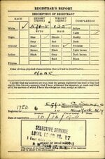
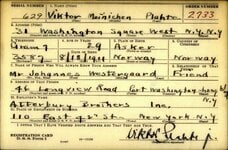
Attached is the location for the Observer Corp post mentioned in the report which was located at the historical Kings Stone additionally, I found a US draft card which may be related.
Just need someone local to verify the location.
All the best for 2025, Alan.
 

Attachments

  • Little Rollright.jpg
    Little Rollright.jpg
    95.1 KB · Views: 2
  • Page 2.jpg
    Page 2.jpg
    244 KB · Views: 2
  • Page 1.jpg
    Page 1.jpg
    267.2 KB · Views: 4
Not at all. Only wish I had more to offer. There are some inconsistencies or unknowns in the report (turning/not turning, cloud height, icing), so it's necessarily guesswork. Also, a cynical read of the reviews by successive seniors suggest they're typical of mishap reports in that they tend to remove findings that might reflect poorly on those decision makers. That's not really pertinent except to note the descriptions might be slightly slanted to make the weather look a bit better than it actually was. But assuming the general observations are correct, it's a bright moonlit night over a relatively thin (1000-2500'), but complete (10/10) overcast cloud layer. Pure speculation, but I suspect the aircraft was slightly South of where they believed, and the terrain was slightly (~500 feet) higher than they thought and the cloud height was a bit lower. I expect it was quite pretty.

As to what happened at the critical juncture, I'd guess it went something like this:
As the aircraft approached the final checkpoint before the bombing range, Flight Sergeant Leseberg should've been trying to find a gap in the clouds to try to get below them for the bombing run. Due to deteriorating weather, he was unable to find a suitable gap, so he decided to orbit and call for a weather update and then penetrate the cloud layer with instruments. After receiving the update, he determined he had sufficient clear air below the clouds (3300' per the latest report) and, after resetting his altimeter, began to descend. Leveling the wings heading North (the direction of generally lower terrain), he looked for a thin spot in the clouds, which would look a bit darker than the rest. Choosing a spot, he pushed forward on the controls to descend, possibly getting steeper than intended. As the aircraft approached the clouds, the scene would get particularly bright, as direct moonlight above combined with the reflection below, and the scene would then go to bright white as they entered the clouds, dimming as they descended. As they broke through the bottom of the cloud deck, their eyes would still be readjusting to a much darker scene, with even darker terrain below. Someone on board noted dangerously high terrain ahead, and they began a recovery, but too late. The engines revved up, and as the nose began to come up, they impacted a slight rise in the terrain.

Finally, there was a good WWII film about a Wellington raid called Target For Tonight. The flying scenes from about 28-30 minutes look typical for those ops:

View: https://www.youtube.com/watch?v=9L8tXDt6Wr4

Hi,

Watched the movie yesterday. Very interesting and educational!

I have also noted the slightly slanted twist of the report ...

I find your hypothetical account of the final minutes very helpful. And with my limited knowledge, also realistic and not overly speculative given the available information.

Then I am trying to reconstruct the positions of the crew members in and around the cockpit. Pilot Leseberg obviously in the pilot seat to the left. Wireless operator Nichols just behind the pilot. Bomb aimer Mitchell probably flat on his belly underneath getting ready for the bomb run exercise. Gunners Redmond and Foote in their respective positions in the rear turret and nose compartment. Lastly, navigators Harris and my granduncle. One probably in the navigator's compartment behind the wireless' position. And the other next to the pilot, likely assisting in altimeter adjustments, cloud gap identification, and remembering or forgetting to turn on the pitot head heater. What do you think? Makes sense?

Best, Jens
 
Attached is the location for the Observer Corp post mentioned in the report which was located at the historical Kings Stone additionally, I found a US draft card which may be related.
Just need someone local to verify the location.
All the best for 2025, Alan.
Hi Alan, ... thank you again! ... your massive contributions have extremely helpful! Best wishes for the new year. Jens
 
1735879553649.png


Re the above.

It has been noted that the aircraft was probably descending as part of its planned bombing run however the 22 degrees may equally come from flying straight and level into a 22 degree rising slope.

I would suspect that the impact angle is actually a combination of decent angle and rising ground.
 

Users who are viewing this thread

Back