Google Earth captures a warbird flying around

Ad: This forum contains affiliate links to products on Amazon and eBay. More information in Terms and rules

syscom3

Pacific Historian
14,797
10,829
Jun 4, 2005
Orange County, CA
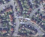
Go to Google earth and fly to this Latitude/Longitude

52 20 10.87N 0 11 43.34W

Zoom in and look what the satellite caught in flight!
 
Here you go, Kiwi
 

Attachments

  • googleearth_image_145.jpg
    googleearth_image_145.jpg
    80.5 KB · Views: 531
Here's another cool one. This is the museum where I volunteer. The bird in front of the 2 hangars is the C-46 Command. You can also see a B-25 in the upper left and 2 SNJs just to the right of the B-25, with a Broussard in between them. In the second row on the right you can spot a Long-EZ.
 

Attachments

  • caf_googleearth_image_555.jpg
    caf_googleearth_image_555.jpg
    68.7 KB · Views: 523
i've seen that before when i tried to play a video of the lanc, someone said i need google earth, i downloaded it, then when i clicked the link for it it just kept taking me back to that...........
 
That's awesome! I've seen some flying planes around busy airports and occasionally at a US air force bases on google. Crazy!
 
syscom3 said:
Van Nuys airport?

I thought more people would be able to indentify this. This is a easy quiz!

You are correct, this located at Van Nuys Airport. But can you indentify what aircraft and aircraft group we are looking at in this picture?

:lol:

Eric
 

Users who are viewing this thread

Back