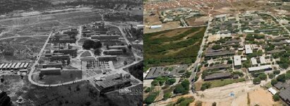
I'm researching an airfield, or what's left of it, near to where I currently stay in Fortaleza Brazil.
This was called Pici Field and was constructed during WWII and abandoned after a few years of use when they constructed a new field called Cocorote (or Adjacento).
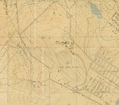
I found various maps, from very high level up to airfield level.
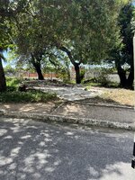
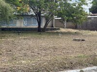
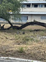
But I am not a pilot, and I am curious to learn if anything could be found on the ground of the infrastructure that used to be there.

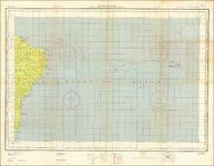
- There is a RBn (Radio Beacon?) tower of 70ft near the Fueling Area, how would it have looked?
- There is a pointer to a spot between 44' and 35' in the top of the map saying FORTALEZA RADIO, would something have been there?
- WYRQ is a frequency? Which frequency?
- 226 UZ, what is that?
- What is Tower PVC / Tower WYRC, is it a ground and approach frequency?

- Again the V box FORTALEZA RADIO mentioned and WYRQ 226 UZ, would this be coming from a tower in the spot on the map?
- I think those beams are meant to locate the airfield, what would such equipment have looked like?

- This map has different info, it says RR and then there is a morse code. It has PICI 84 and ADJACENTO is 81.
- There is an H Rbn box, H being for homing? How does that work, which equipment does that?
From the same map:


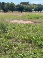
We have not been able to identify what this has been used for, it's located near the area with the small buildings and the parking ramp.
I want to go again after I know more about what I am looking for.
This was called Pici Field and was constructed during WWII and abandoned after a few years of use when they constructed a new field called Cocorote (or Adjacento).
I found various maps, from very high level up to airfield level.
But I am not a pilot, and I am curious to learn if anything could be found on the ground of the infrastructure that used to be there.
- There is a RBn (Radio Beacon?) tower of 70ft near the Fueling Area, how would it have looked?
- There is a pointer to a spot between 44' and 35' in the top of the map saying FORTALEZA RADIO, would something have been there?
- WYRQ is a frequency? Which frequency?
- 226 UZ, what is that?
- What is Tower PVC / Tower WYRC, is it a ground and approach frequency?
- Again the V box FORTALEZA RADIO mentioned and WYRQ 226 UZ, would this be coming from a tower in the spot on the map?
- I think those beams are meant to locate the airfield, what would such equipment have looked like?
- This map has different info, it says RR and then there is a morse code. It has PICI 84 and ADJACENTO is 81.
- There is an H Rbn box, H being for homing? How does that work, which equipment does that?
From the same map:
We have not been able to identify what this has been used for, it's located near the area with the small buildings and the parking ramp.
I want to go again after I know more about what I am looking for.
Attachments
-
 IMG_3067.JPG337.2 KB · Views: 76
 -
 blimps (14).jpg35.6 KB · Views: 70
 -
 blimp2.jpg14.5 KB · Views: 61
 -
 16700440_955928897876483_4257899598933637500_o.jpg105.7 KB · Views: 68
 -
 11717518_874515685917474_9164139287777673059_o.jpg170.2 KB · Views: 67
 -
 204961989_1128813614291732_5809697212967541073_n.jpg22.8 KB · Views: 77
 -
 IMG_0539.JPG134.6 KB · Views: 72
 -
 87085.jpg294.7 KB · Views: 87